According to a paper written by local scholar and researcher of Aboriginal history, Father Dr Eugene Stockton, the Blue Mountains were a region favourable to early human occupation, featuring plentiful water and food, tool making stone and rock shelters. Lying between Gundungurra (the Cox River people) and Dharug (Cumberland Plain) territory, Dr Stockton believes that the abundance of art in the Central Blue Mountains region represents a neutral ceremonial boundary between the two.
There are hundreds of Aboriginal sites spread over the Blue Mountains dating back at least 22,000 years, however the location of many are a closely guarded secret in order to preserve and protect them. The Aboriginal sites include rock shelters, axe grinding grooves, rock engravings and cave paintings. The Blue Mountains also have a number of designated Aboriginal Places, an area of land recognised as having special significance to Aboriginal people.
Please bear in mind when visiting these sites that they are thousands of years old. Be respectful and do not touch. It is an offence to desecrate an Aboriginal site.
Remember to check the National Parks website for any track alerts or closures before heading into National Park.
This post contains affiliate links. Making a purchase through these links earns a small commission at no additional cost to you and is a great way to show your support to this site.
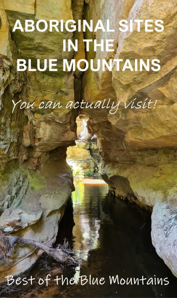
Take a self guided tour of Aboriginal Blue Mountains
Your self-drive tour of the Blue Mountains commences at Glenbrook and includes accessible, and known, Aboriginal sites. The sites are in order travelling up the mountain, and travel times between each location have been provided to enable you to select sites and plan your day. Should you wish to complete these over two days instead, check out accommodation options at the bottom of this post.
Blue Mountains indigenous sites
Glenbrook Aboriginal sites
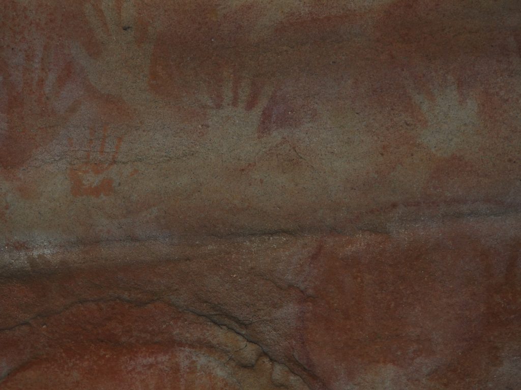
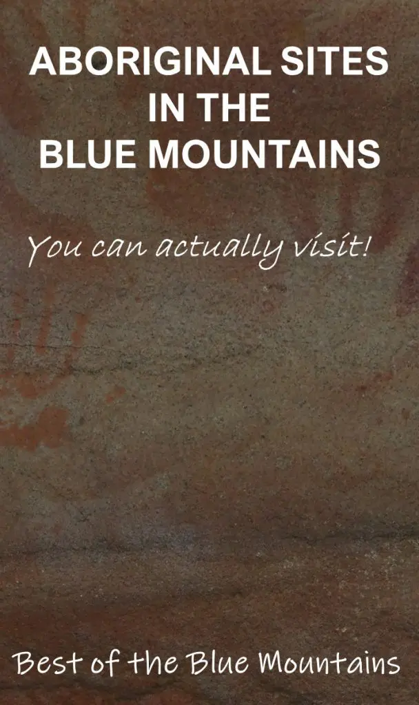
Red Hands Cave
Site Type: Aboriginal rock art
About the site: A significant example of an Aboriginal rock art site in the Blue Mountains, Red Hands Cave contains over forty hand stencils from both adults and children, which were created by spraying ochre from the mouth over a hand pressed against the rock. It also contains handprints, a banana shaped figure and four balloon shaped outlines.
Recognised by the NSW State Government as an Aboriginal Place in 2015, the site is a ceremonial cave which was used for the initiation of warriors. The cave is now fenced off to protect it from damage but the art is easily visible through. It is estimated to have been painted between 500-1600 years ago.

How to find it: Red Hands Cave is located in the Blue Mountains National Park at Glenbrook. A walk is the only way to get there.
From the entrance gates there are two ways to access it;
- The short way is from the Red Hands Fire Trail, 8 kilometres down the Oaks Fire Trail. This is an easy 4.5 kilometre loop to the cave, passing Campfire Creek on the return route.
- The longer route is via the Campfire Creek track which commences at the Causeway. This is a more difficult 9.2 kilometre circuit.
Timing: Allow 2 hours from the carpark on the short route plus 15 minutes driving in National Park, 4 hours on the long route and 5 minutes driving in National Park.
Campfire Creek
Site Type: Grinding grooves
About the site: Grinding grooves are a common sight in the Blue Mountains. They are formed by the local Aboriginal people sharpening or making tools, probably stone hatchets, on the sandstone and wearing grooves in the stone. They are usually found near water which was added to the stone to aid the process.
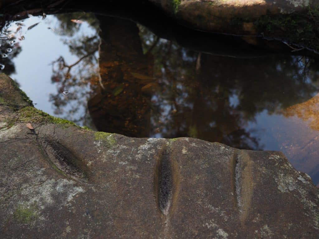
How to find it: Either method of accessing Red Hands Cave will cross Campfire Creek. Walk up the stone bedrock and you will see a number of distinct grooves in the rock.
Timing: Included in time allowed for Red Hands Cave
Yarramundi Aboriginal sites
Shaws Creek Aboriginal Place
Site Type: Aboriginal Place, rock carving and shelter
About the site: A central meeting place for people from the wider Sydney basin, Shaws Creek has a large rock shelter just before it joins the Nepean River which contained a deep deposit perhaps as old as 20,000 years. A large amount of stone flakes and over 600 bone fragments were excavated from this site in 1979 and 1980.
Shaws Creek was formally recognised as an Aboriginal Place in 2014, which provides special recognition and protection to the local Aboriginal cultural landscape. Rich in resources, Shaws Creek was able to support large numbers of people and contained a wealth of trees suitable for making spears. It was the likely location of a conflict with settlers in 1805 which resulted in the deaths of a vague number of Aboriginals, perhaps 7 or 8. What happened to their bodies is not known.
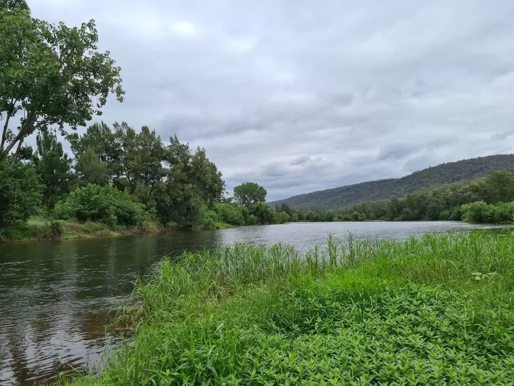
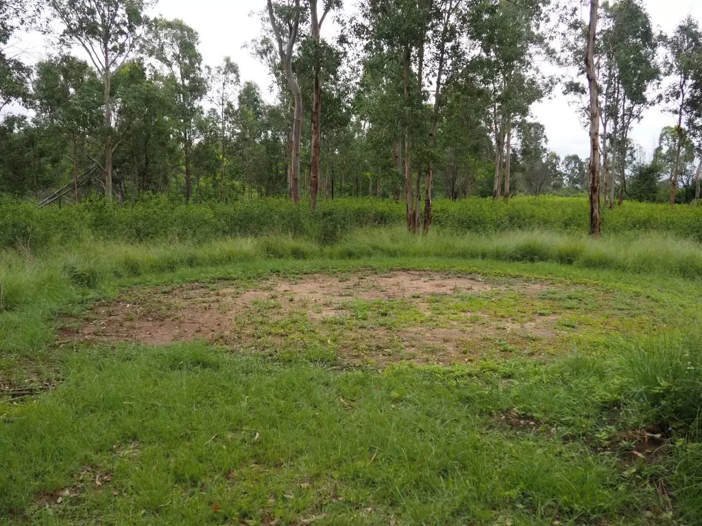
How to find it: Shaws Creek can be found at 810 Springwood Road Yarramundi, there is a small carpark before the bridge over the creek. A road beyond the gate leads to the recreation area where there are toilets and a large picnic shelter.
This site isn’t well maintained and is very overgrown. It is easy enough to follow the road to the river, which was pretty, but it didn’t bring me past the promised ruins of the farmhouse and I wasn’t able to locate any trails branching off. One clear mowed path through the grass opposite the picnic shelter led me to a circular clearing, which I presume is for corroborees. I also did not locate the rock shelter near the river referred to in my research.
Timing: 60-90 minutes if you would like to have a wander around Shaws Creek Aboriginal Place.
Travel time: Approximately 32 minutes from the Red Hands Cave track
Faulconbridge Aboriginal sites
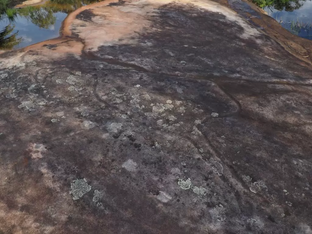
Ticehurst Park
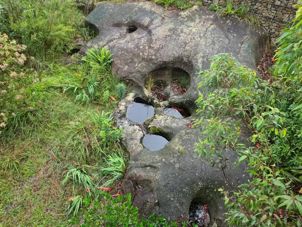
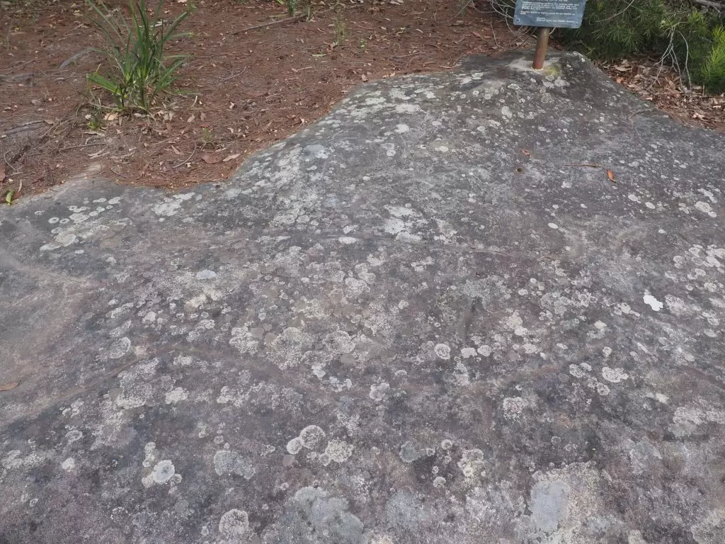
Site Type: Grinding grooves and rock carving
About the site: I love this Aboriginal site because there is so much to see! This rock ledge that stretches behind houses contains carvings of 3 distinct emus, once prevalent in the Blue Mountains, numerous grinding grooves, mundoes (footprints – I think I’ve found 6), and a number of watering holes.
I haven’t been able to locate a reference to the age of this site in my research. I have read that the carvings across the site depict an Emu hunt.
This is a pretty good spot to check out the sunset too!
How to find it: The Ticehurst Park site is literally in the middle of a residential area, the engraved rock ledge runs behind several houses.
This is an easy enough one to find. Turn right off the Great Western Highway onto Bellevue Road, then left onto Jeffs Road and follow it around to the cul-de-sac. A nature strip runs between two houses to the rock ledge and a sign at the front marks your arrival.
You can check out my video on the site which will help you locate the individual carvings.
Timing: Allow 15 minutes to walk around the site which is approximately 150 metres from parking.
Travel time: Approximately 21 minutes from Shaws Creek Aboriginal Place
Hazelbrook Aboriginal sites
Horseshoe Falls
Site Type: Shelter
About the site: My research found a number of references to excavations and tools found at Horseshoe Falls which were older than 7,000 years. The only detail I have located regarding the site is “a terrace just downstream of Horseshoe Falls” accompanied by a picture of the first fall on this track. I would presume the site to be the next falls along, confusingly labelled as both Horseshoe Falls and Glow-worm Nook Falls, which has a large cavern behind it. At the time of occupation this may have been dry.
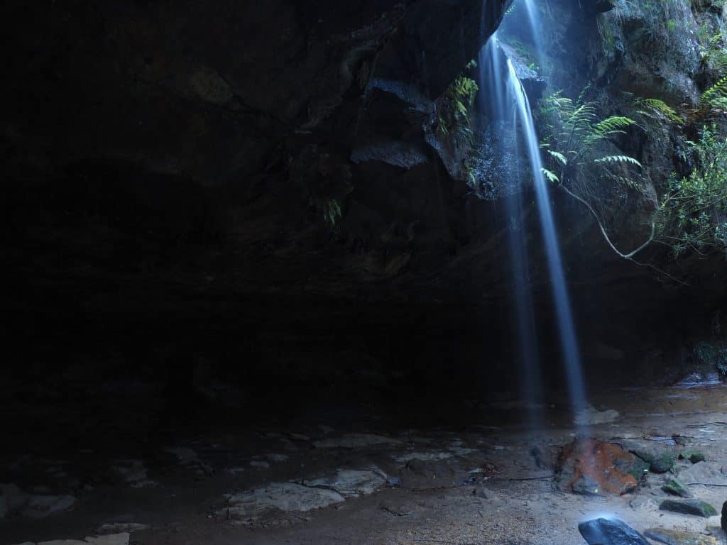
How to find it: One of my absolute favourite walking tracks in the Blue Mountains, the entry to the track is located approximately one kilometre down Oaklands Road on the right hand side. Turn around in Brook Street to park in the clearing near the entry. These falls are a short scramble off the main track one kilometre from the Oaklands Road entry.
Timing: 40 minutes in and out for these falls
Travel time: Approximately 10 minutes from Ticehurst Park
Read more about Horseshoe Falls.
Gloria Park
Site Type: Aboriginal Wells, grinding grooves, rock shelter and potentially a rock carving
About the site: There were originally around 20 wells here but some were covered up when the road was widened. The wells were excavated in the 1920’s and what were believed to be spearheads were found. A nearby rock shelter, unfortunately now heavily graffitied, also revealed an axe. A group of the wells can easily be seen alongside the highway.
How to find it: Don’t just put Gloria Park into your GPS as it will take you to the wrong side of the park and quite a distance from the site.
The wells are located literally right next to the highway, in fact some are now covered by the road. The easiest way to see them is to park at Hazelbrook shops and walk a short distance up the highway, the walkway curves around the wells to offer a view from above.
Timing: Less than 10 minutes if viewing from the pedestrian path above.
Travel time: Less than 5 minutes from Horseshoe Falls walking track
Lawson Aboriginal sites
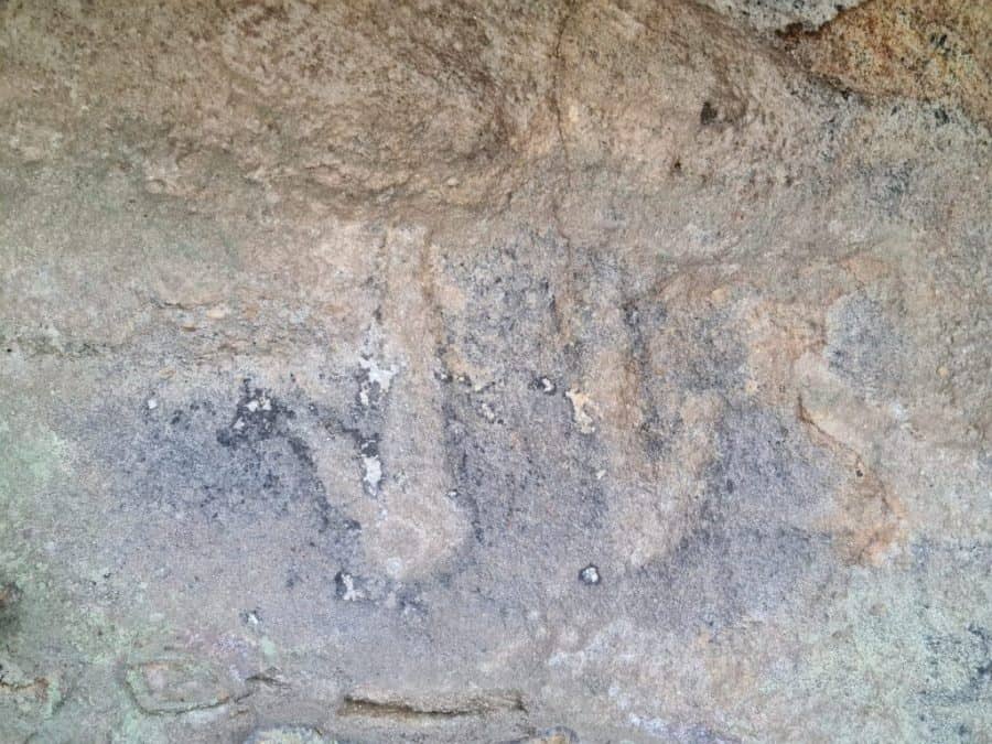
Old Man Kangaroo
Site Type: Rock carving
About the site: I’ve been unable to locate an estimate of age of this rock carving. Unlike the Ticehurst Park emus, the lichen on the rock make this carving difficult to photograph. I have edited the below image to bring out the contrast.
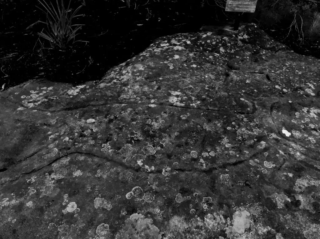
How to find it: Turn onto Queens Street Lawson and then take the first left onto Kangaroo Street. The site is signposted and a short way up the road.
Timing: 5 minutes, the site is right beside the car park.
Travel time: Approximately 5 minutes from Hazelbrook wells.
Wentworth Falls Aboriginal sites
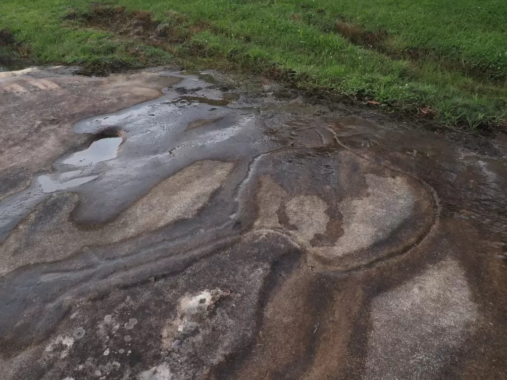
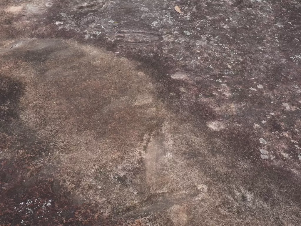
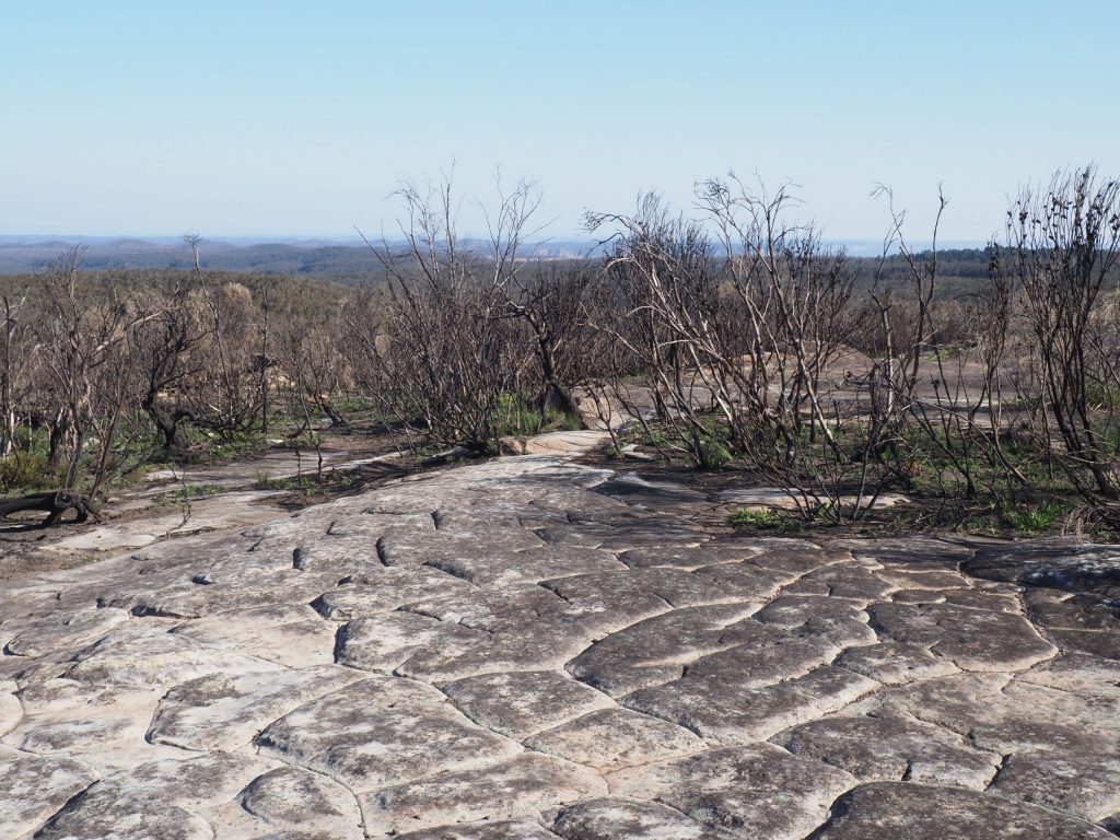
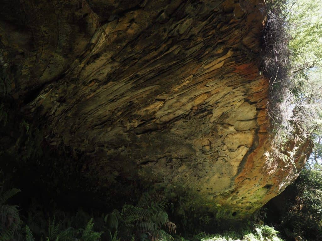
Kings Tableland Aboriginal Place
Site Type: Grinding grooves, shelter and rock carvings
About the site: Kings Tableland is the oldest site of Aboriginal occupation in the Sydney Basin at 22,000 years, excavation revealed over 3,000 artifacts. It was used as a gathering place for the Gundungurra people and a place to meet with neighbouring Aboriginal groups, as an art gallery and as a story telling place. With far reaching views to Sydney it was from here the Gundungurra kept watch on the approach of Blaxland, Lawson and Wentworth as they sought a path over the mountains.
There are two parts to this site. The rock platform above has over 150 grinding grooves and numerous waterholes while the rock shelter below features a number of wall carvings.
There is a deeper part of the shelter not evident in the image above. On the wall of this part you will find animal tracks carved into the wall. These are the most evident ones, you will need to look carefully for others.
How to find it: Another site not far out of a residential area, entrance to this part of the tablelands is a dirt track at the bottom of Queen Elizabeth Drive, which is on the left off Tablelands Road. This isn’t a wide road so you will be better off parking on Tablelands Road and walking down, its almost a longer walk than the track out to the site!
Veer left at the first information sign to find the shelter and rock carvings and continue straight to the rock platform above for the grinding grooves.
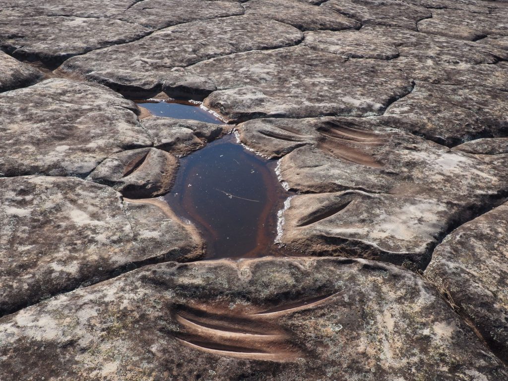
The platform is quite remarkable in its own right due to the views and the rock features which may be the result of peri-glacial activity between 15,000 and 30,000 years ago.
Timing: 1 hour to walk to and around the site
Travel time: Approximately 10 minutes from the Lawson Kangaroo carving
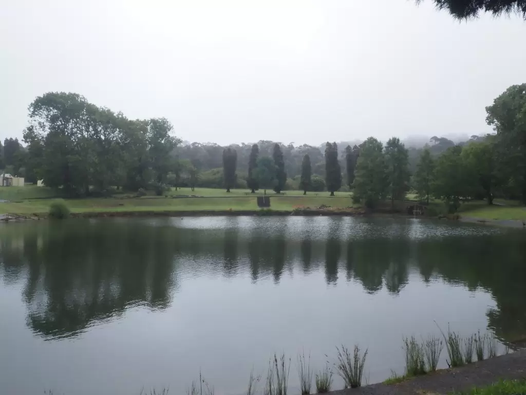
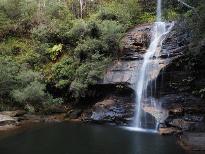
Leura Aboriginal sites
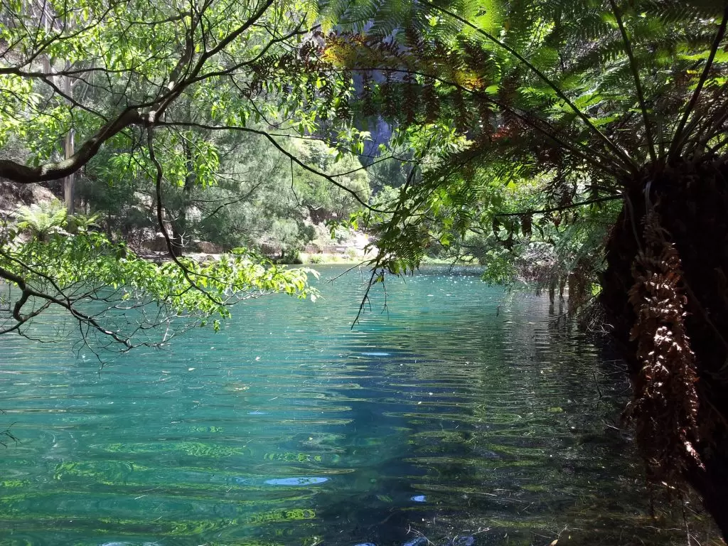
Lyrebird Dell
Site Type: Shelter
About the site: Artifacts found in the floor of the large sandstone cave indicate Lyrebird Dell was used as a shelter at least 12,000 years ago.
How to find it: You can start this loop track from either side. Park at Gordon Falls Reserve in Leura, walk down to the Pool of Siloam, one of my favourite waterfalls in the Blue Mountains and worth a look in its own right, then continue along the trail to Lyrebird Dell. You can also start from the other side which starts on Lone Pine Avenue near Leura Oval. Its a lot of steps down to the Pool of Siloam so it is the easier side to start from if you intend to do the full loop.
Timing: The loop including the Pool of Siloam is less than 2 kilometres, allow 45-90 minutes depending on your pace and whether you want to do the full loop or just visit Lyrebird Dell.
Travel time: Approximately 15 minutes from Kings Tableland Aboriginal Place
Katoomba Aboriginal sites
Three Sisters Aboriginal Place
Site Type: Aboriginal Place
About the site: It’s the most iconic image of the Blue Mountains there is, and the Three Sisters are also significant to the Aboriginal people. There are several versions of the Aboriginal legend that explain the origins of the unusual sandstone formations, two involve the turning of three sisters to stone by a witch doctor in order to protect them. In one version the witch doctor was killed while in the other he changed into a lyrebird and in the process lost his magic bone. He now spends his days looking for his bones while the steadfast sisters watch over the valley.
The Three Sisters was declared an Aboriginal Place in 2014 in recognition that they are connected to Aboriginal myths, ceremonies and legends. For the local Aboriginal tribes, the sisters are a place of their ancestors. Despite numerous references still online to an Aboriginal Cultural Centre at Echo Point, the centre is no longer operating. You can purchase Aboriginal themed art and gifts at the Visitors Centre.
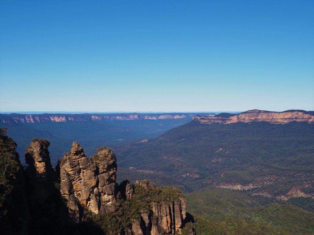
How to find it: Head for Echo Point lookout at the End of Echo Point Road. From here you can check out the view of the sisters and take a walk down closer, you can even walk across a bridge to the first sister.
For a clear view across the valley without the crowds of tourists, head for Eagle Hawk lookout.
Timing: Allow 1 hour if you want to walk down to the first sister and 20 minutes if you just want to check out the views!
Travel time: Approximately 11 minutes from the Gordon Falls Reserve
Note this is a paid parking area.
The Gully Aboriginal Place
Site Type: Aboriginal Place
About the site: A small racetrack that was famous for events in the 60’s and 70’s, Catalina Park was permanently closed and abandoned when it was declared a sacred Aboriginal Place in 2002. These days you can still stroll along the original race track, but a stroll on The Gully Walk through the park tells a story of its Aboriginal history.
Before the arrival of the Europeans, The Gully was an abundant resource for the Aboriginal people and it was used as a seasonal living place, hunting ground and for ceremonies. As European settlement expanded in the 1800’s and displaced local tribes, many chose to make The Gully their home and by 1910 it had become a close community joined by non-Aboriginal families and people needing shelter. The community thrived until the late 1950’s when the racetrack was installed. Descendants of this community describe it as a great place to live and grow up and worked hard to have it declared an Aboriginal Place.
How to find it: Also known as Catalina Park, head for 21 Gates Avenue in Katoomba.
Timing: It is definitely worth taking The Gully walk and reading the stories of its once inhabitants. It is only 1 kilometre, allow 30-40 minutes to read the history as you go.
Travel time: Approximately 10 minutes from Echo Point
Minni Ha Ha Falls
Site Type: Sacred women’s place
About the site: The sign at the entry to Minni Ha Ha Reserve declares this spot to be a place of significance to the Aboriginals. I found a couple of references to this being a sacred women’s place, meaning men were not permitted. These places may include places of education, ceremony and birthing areas, perhaps why women’s places are often near water.
The walk is quite short at 1.2km one way, and quite easy until the grated stairs to get down the cliff to the falls. The view is definitely worth it from the bottom, but the top of the cliff also offers some great views of the falls.
How to find it: Don’t just put this one into your GPS, you’ll most likely end up on a road in the middle of nowhere. Instead head for Minni Ha Ha Road and park at the Minni Ha Ha Reserve which is at the end of the road.
From the carpark the track starts to the left of the information sign.
Timing: Depending how long you spend down the bottom (its a spectacular swimming hole) you could do this in and out in under 90 minutes.
Travel time: Approximately 11 minutes from The Gully
Blackheath Aboriginal sites
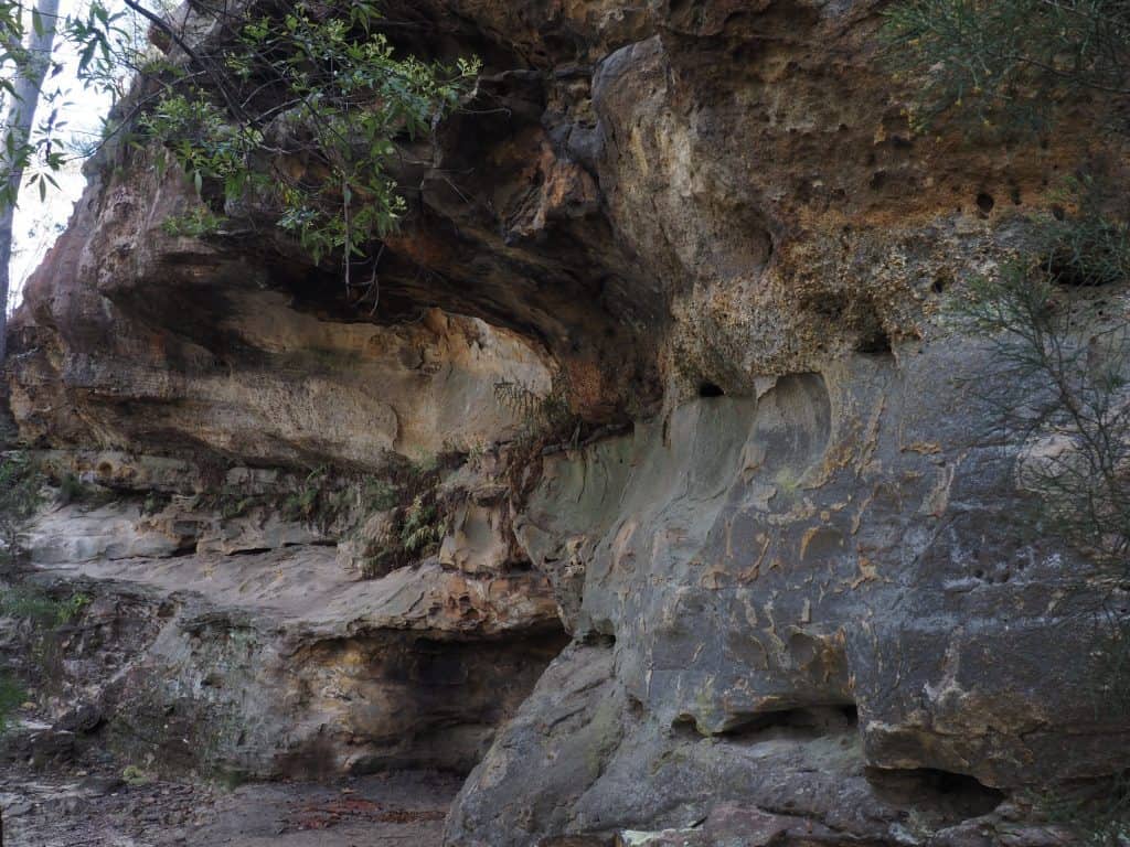
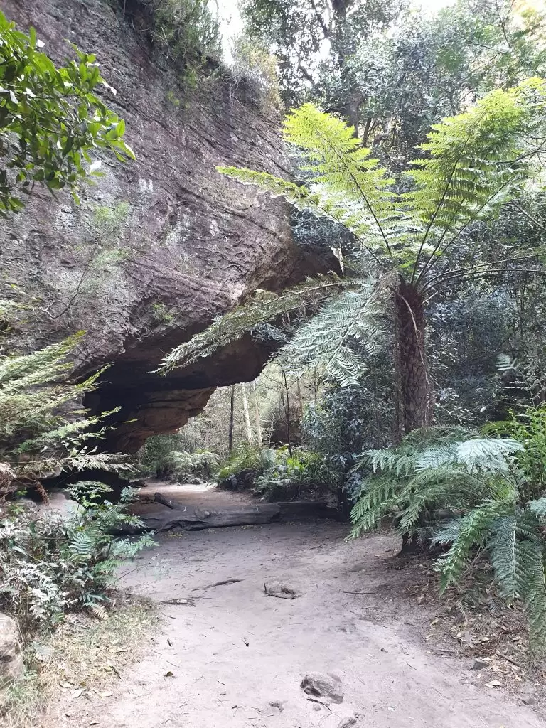
Walls Cave
Site Type: Shelter and sacred Darug women’s place
About the site: Walls Cave is an immensely large cave that is impossible to capture in a single shot. Archaeological excavations of the cave found a buried hearth which was at least 12,000 years old. Walls Cave is located in the traditional lands of the Darug people and being close to water is a woman’s site. Along the ridge is a special men’s site. While there is no water flowing in the cave itself, Greaves Creek flows into the wider canyon and must be crossed in order to reach the cave.
A fenced platform has been installed on the floor of the cave and visitors are requested not to go beyond this.
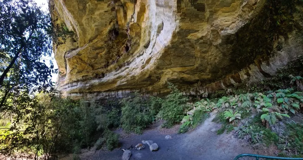
How to find it: Turn onto Walls Cave Road from Evans Lookout Road in Blackheath. The track starts beyond the gate.
Timing: The walk is 2.5 kilometres return, allow 60-90 minutes depending how much time you’d like to admire the cave.
Travel time: Approximately 15 minutes from The Gully to the car park for Walls Cave.
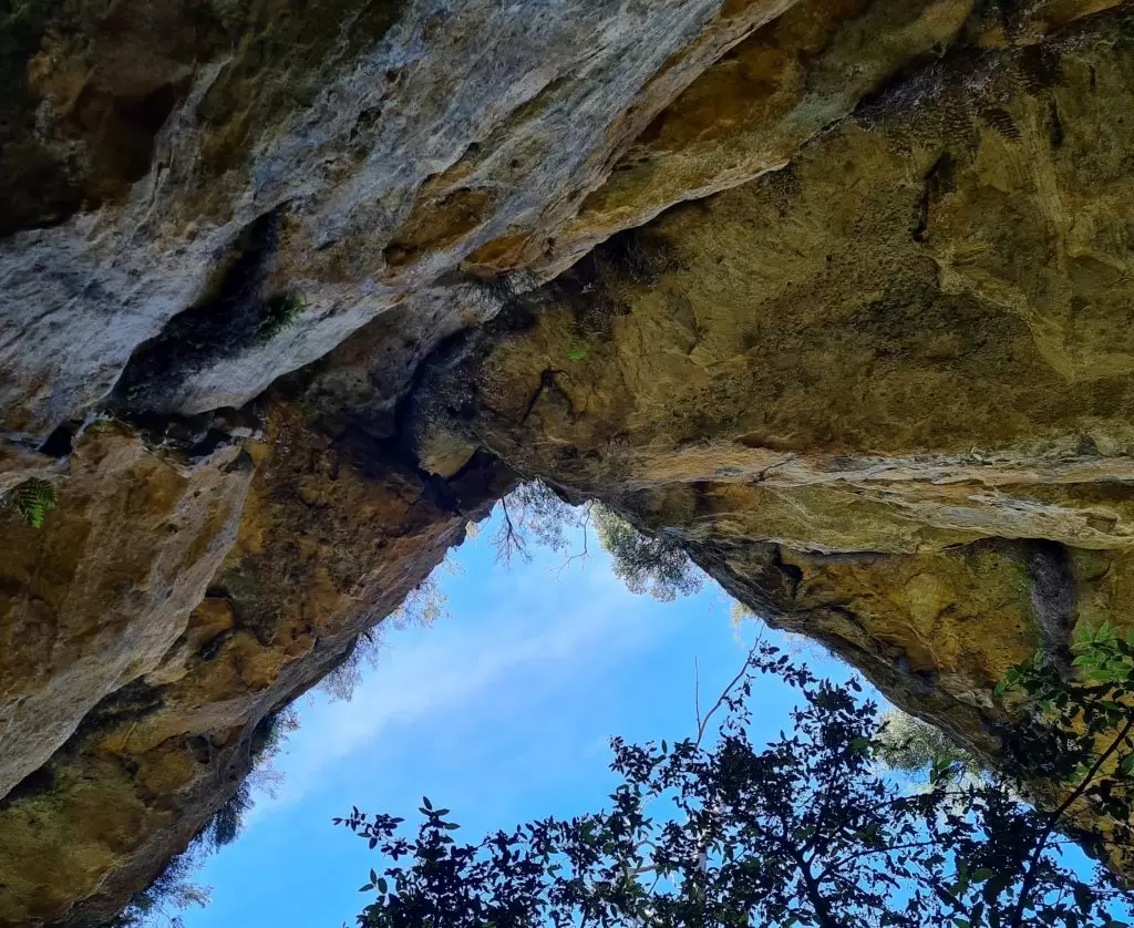
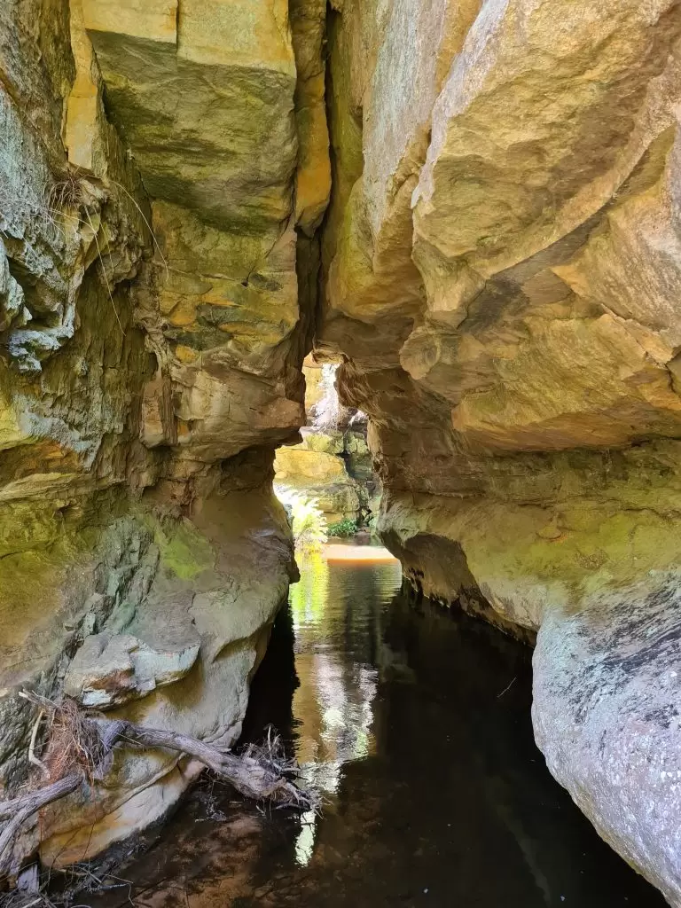
Grand Canyon
Site Type: Shelter
About the site: Easily one of the most picturesque walks in the Blue Mountains, The Grand Canyon track also features a large, sandy floored overhang beside Greaves Creek called the Rotunda, which was used as an Aboriginal shelter.
How to find it: Head for Evans Lookout in Blackheath to find one end of the track. The track comes out of the canyon further up on Evans Lookout Road. The Rotunda is located near the start of the climb out of the canyon.
Timing: This popular walk is definitely worth doing if the weather is good, but it does get busy. The full walk takes about 4 hours.
Travel time: Less than 5 minutes from the Walls Cave car park.
Read more about the spectacular Grand Canyon Loop.
Jenolan Aboriginal sites
Jenolan Caves
Site Type: Place of healing
About the site: While there’s a good chance that this extensive cave system was also used as shelter, according to Jenolan Caves the Aboriginals believed the waters here have healing properties, and would carry their sick to bathe in the underground waters. They also believed the crystal formations to have powers for spiritual well-being and the men used them in their ceremonies. This was also a place where women’s medicine and food could be found.
The Jenolan Caves system are the oldest discovered caves in the world and are part of the UNESCO listing for the Blue Mountains world heritage status.
How to find it: West of the Blue Mountains, Jenolan Caves is approximately 74 kilometres from Katoomba. Continue on the Great Western Highway and turn onto Jenolan Caves Road just before Hartley. This road will take you straight to the caves.
Timing: This site is worth a day trip in itself with so much to see. Allow half a day if you don’t plan to do a cave tour.
Travel time: A little over an hour from the Grand Canyon
You can check out more on Jenolan Caves
If you’re interested in walking in the Blue Mountains, it is worth investing in a copy of Blue Mountains Best Bushwalks for some great ideas.
You should also bear some basic safety essentials in mind when bushwalking in the Blue Mountains.
My Photography Equipment
If you are interested in checking out the equipment I use and the results I get check out my photography journey.
Where to stay in the Blue Mountains
If you’re looking to make it a weekend of exploring, check out some accommodation options below.
Enjoyed this glimpse into the Aboriginal history of the Blue Mountains? Share below!
This is such an important and awesome post. I had no idea just how many wonderfully preserved Indigenous sites there are in the Blue Mountains. I will endeavour to visit the next time I’m in Sydney!
I love history so I would enjoy visiting all of these spots. I especially love the cave drawings.
This is awesome! I love the Blue Mountains, but have not really heard of many of these sites. Definitely need to plan another trip there to explore more.
I love Aboriginal art, but I didn’t realise there were more sites to visit than those with art. Definitely want to explore the Blue Mountains one day.
I work at Mt Tomah botanical gardens & have been told of Emu caves & that if us close to where I work as a cleaner I would love to visit this sacred place but have no idea where it is. I am proud Wiradjuri man.
I know that the Emu Cave is definitely close to Mt Tomah. I know of someone who is happy to give me its location and will see if I can find it when I have the chance 🙂
Hi Brad I can help you locate Emu cave if you haven’t found it as yet
It’s so easy to find that you probably drive past it every day on your way to work Big Braddy Boy!