
Looking to head somewhere picturesque and fun with the pup this weekend? Since the majority of the Blue Mountains is a National Park, it’s easy to assume that automatically means no hiking with the family pooch. If you know where to look though, there are some fabulous bushwalks in the Blue Mountains that are 100% dog friendly because they are technically on Council land.
Now I’m not a dog owner myself, and I can’t see my cats being keen on the idea, but my regular hiking buddy is so we are always on the lookout for the great spots we can bring the dogs along! A number of these also feature waterfalls that your dog will love on a hot summers day.
I’m always on the lookout for dog friendly Blue Mountains walks so expect this list to grow!
Remember don’t forget to carry some bags for any ablutions and all dogs should be on a lead at all times, some of these walks get quite busy and even the friendliest dog can frighten a small child or person who is afraid of dogs.
Dog friendly walks in Glenbrook
Knapsack Reserve
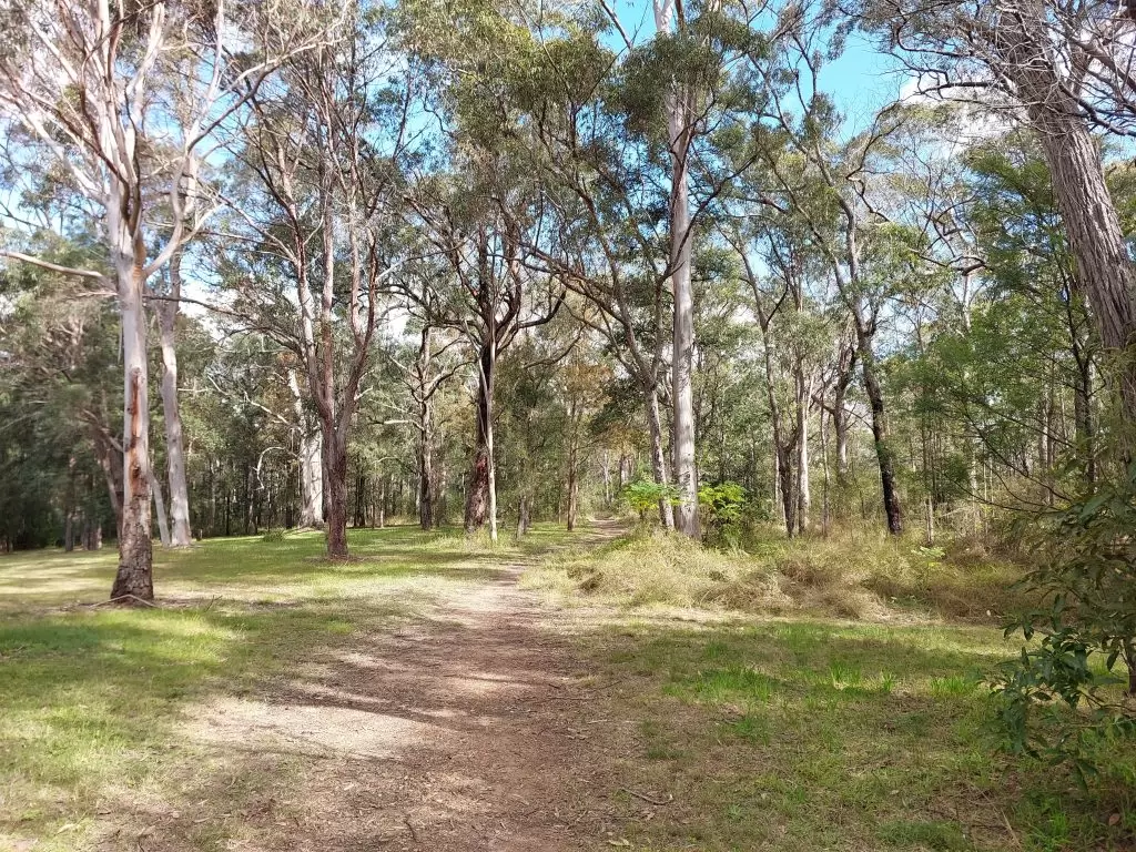
This reserve in Glenbrook contains a number of short routes perfect for taking the pupper for a stroll;
– Marges Lookout; 1.3km one way
– Elizabeth Lookout; 1.1km one way
– Lennox Bridge via Marges Lookout; 1.8km one way
– Knapsack Bridge via Elizabeth Lookout; 1.6km one way
– John Whitton Memorial via Elizabeth Lookout and Knapsack Bridge; 2.4km one way
The route to the two lookouts is a fire trail and is a reasonably flat and easy walk.
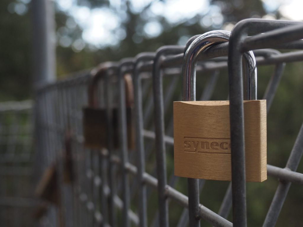
Look for the padlocks at one of the lookouts and some wildflowers along the way at the right time of year!
How to find Knapsack Reserve
There are multiple points you can access this reserve that you might choose based on what part you want to head to. The easiest one is the entry on Barnet Street in Glenbrook which has some parking available.
Length: Variable depending on route chosen. If you visit both lookouts and return it is a little under 3.5 kilometres in total.
Duration: Variable depending on route chosen. For both lookouts it is approximately 40 minutes return.
West Glenbrook Reserve
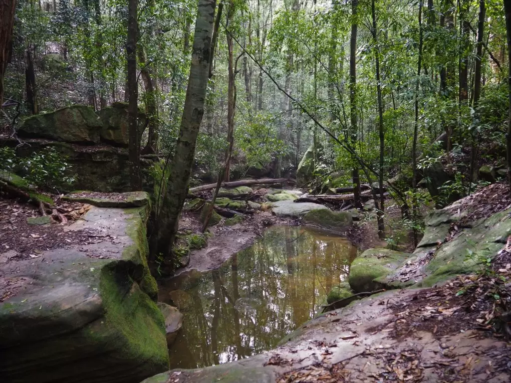
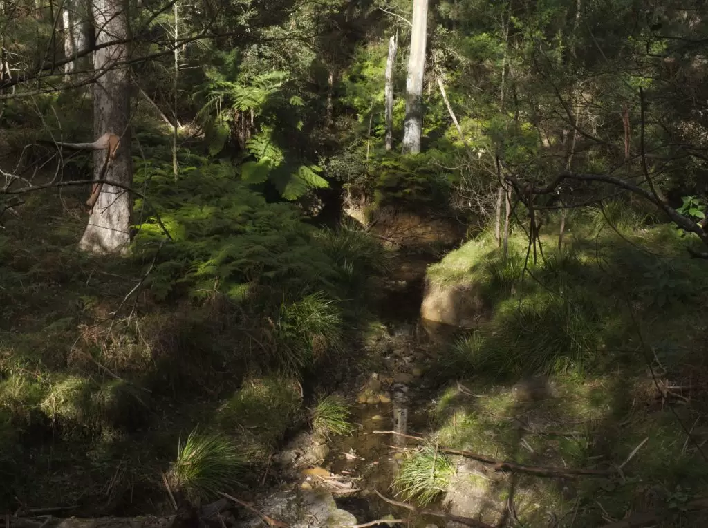
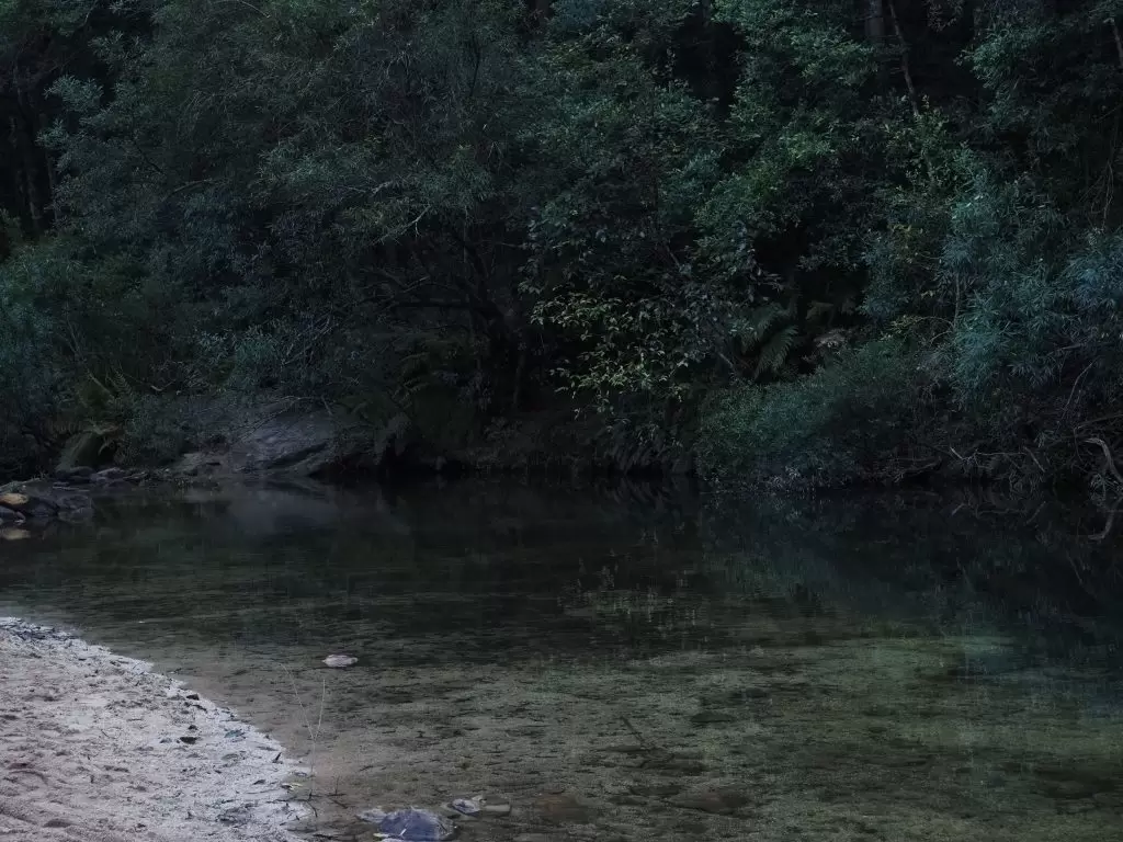
A recent discovery on my wanderings, this is a lovely reserve that borders the National Park and contains tracks providing access to some of the swimming holes on Glenbrook Creek. Part of it is owned by the Deerubbin Aboriginal Land Council and is a place of cultural significance, while the other part is crown land. There are a number of tracks that wind through the bush and not only are dogs (currently) permitted but it’s a great location for spotting a variety of the tiny Australian birds of the Blue Mountains. The main track is relatively flat.
How to find West Glenbrook Reserve
The Reserve starts at the end of Station Street in Glenbrook, marked by a sign saying Station Street Firetrail. There is only street parking available.
Length: As there are a number of tracks that run off the main one this could be made as long or as short as desired.
Duration: Variable dependent on route chosen.
Dog friendly walks in Blaxland
Lennox Bridge
This one could count as either Glenbrook or Blaxland and it can link up with the Knapsack Reserve walks.
Lennox Bridge is the oldest bridge in NSW, and it is the starting point for one of the few approved off-leash walks in the mountains. It can be done as a loop, running up one side of the creek and coming back down the other side of it to finish on the other side of the bridge. I haven’t done the full track myself, but there were some small inclines in the part that I did do.
Where to find Lennox Bridge
Lennox Bridge can be found on Mitchells Pass. There is some parking available on each side of the bridge which generally isn’t full. Beyond the bridge is one way down to Emu Plains so it is only able to be accessed from one side.
Length: I have read that this track is about 1 kilometre in length
Duration: The council sign at the bridge showing the route indicates a 45 minute duration
Winnicoopa Fire Trail
Popular with walkers, cyclists and bird photographers, Winnicoopa is a nice little fire trail that runs off the end of a residential street. It features a number of deviations from the main track that climb up, and it eventually connects with another, sandy fire trail that connects with a number of other tracks connecting Blaxland, Mount Riverview, Warrimoo, Sun Valley and Yellow Rock. This is one of my favourite walks in the mountains for seeing birds.
Where to find Winnicoopa Fire Trail
The trail commences at the end of Winnicoopa Road in Blaxland. This is a residential area so there is only street parking available.
Length: Given this is an in and out walk, or a walk ending in a destination other than your starting point, you can set your own preferred length and duration.
Dog friendly walks in Springwood
Birdwood Gully
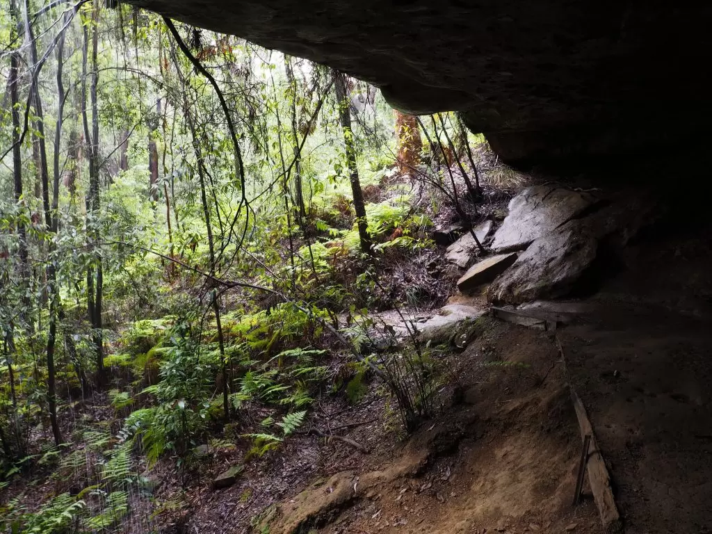
One of my local bushwalk routes, I actually used to run this route a long time ago in my very much younger days! It’s still lovely and popular with dog owners and non-dog owners alike. It is an easy track which roughly follows along Springwood Creek until it meets up with Shelley’s Creek and follows it for a while. It’s a great walk for the kids too, download a map and activity guide for the kids to follow along, with the creeks, water crossings, a cave, a small waterfall, and plenty of native foliage there is plenty for them to check out while the pup is splashing around!
How to find Birdwood Gully
There are actually three access points onto the Birdwood Gully track, from Bednal Road, Boland Road and Lucinda Avenue. Boland Road and Lucinda Avenue are both residential streets, and the entry on Boland is on a blind bend of a steep hill. I would recommend parking in Plateau Road and walking the short distance to either Lucinda or Boland to commence the walk. I generally start from Boland and walk out at Lucinda. There are some steps out.
Length: Less than 3 kilometres
Duration: Approximately 1 hour
Sassafras Gully and Wiggins Track
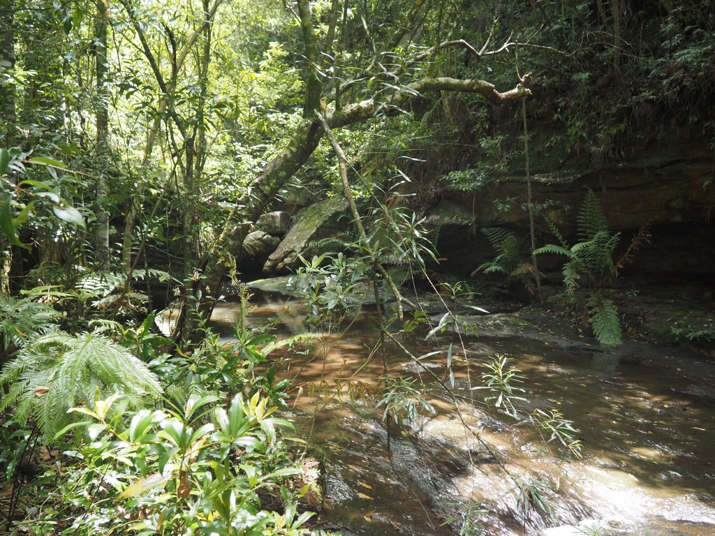
On the other side of the highway in Springwood is one of the longer dog friendly options in the mountains. I have done this track as a part of a larger route which included the Victory Track, which crosses into National Park. Given this council land does border the National Park it is important to stick to the council side. Parts of this track will follow Sassafras Creek so there are spots for your furry companion to splash around.
How to find Sassafras Gully and Wiggins Track
There are two options you have for this route, a circuit loop that stays in Springwood or starting at Faulconbridge Station and walking through the gully to Springwood.
The circuit route starts from the end of Sassafras Gully Road.
The straight route commences near Faulconbridge station on the right hand side of number 10 Sir Henry’s Parade.
Length: Approximately 5 kilometres for the circuit, close to 7 kilometres from Faulconbridge Station.
Duration: Not having done the full track of this route I can only go off the Blue Mountains Best Bushwalks listing which puts the circuit at 2.5 hours and the one way at 3 hours.
Dog friendly walks in Sun Valley
Sun Valley Fire Trail
Also referred to as Rosenthal Lane, this fire trail follows the path of Fitzgerald Creek to join up with Long Angle Creek.
There are a number of different options for trails you can take off this one, the main trail will take you to Yellow Rock, but there are smaller tracks branching off that lead to Warrimoo, Blaxland or Mount Riverview. It’s a good idea to have an app like All Trails open (This one is listed under Long Angle Fire Trail) as there are no signs for any of the alternate tracks.
Until it meets Long Angle Creek this track is mostly flat, with a couple of gentle inclines. It’s a good option for the pups that have difficulty with steps, hills or uneven tracks and it is one of the popular local dog friendly walks.
How to find Sun Valley Fire Trail
Head to Rosenthal Lane off Sun Valley Road. The lane becomes the fire trail so there is no parking in the lane itself, you’ll need to park on Sun Valley Road itself.
Length: If you head for the junction with Long Angle Creek its approximately 3.3 kilometres from the entrance. To do the full track to Yellow Rock is about 6km one way.
Duration: This is an easy walk you can do in 90 minutes without too much difficulty.
Dog friendly walks in Hazelbrook
Horseshoe Falls Walking Track
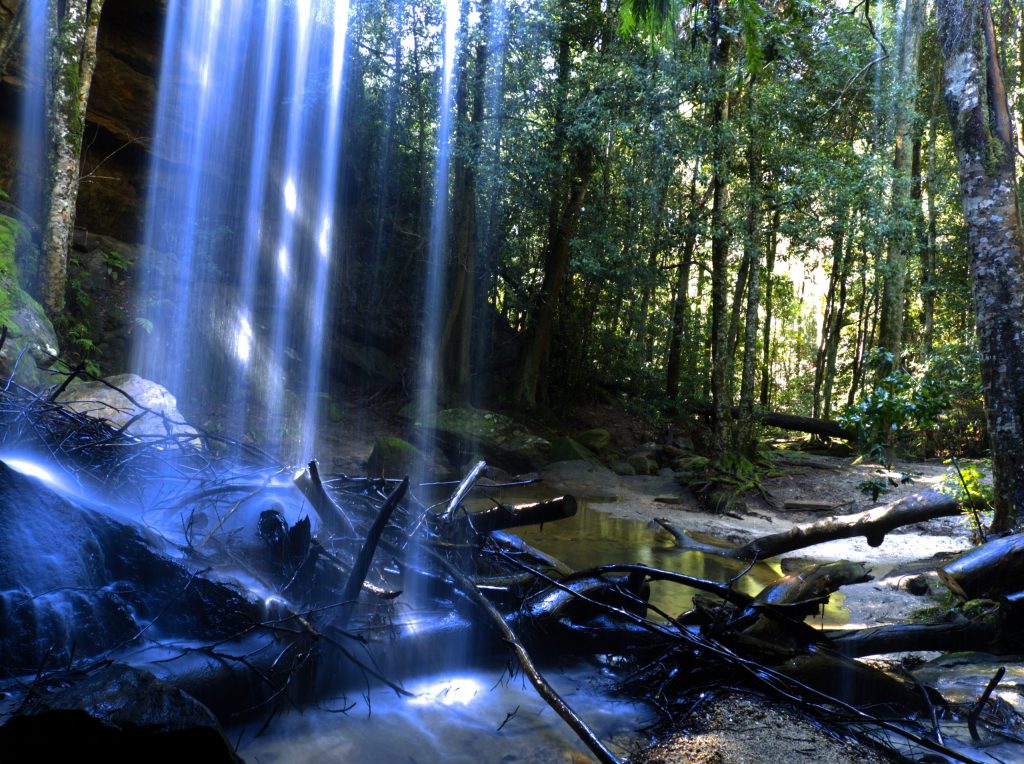
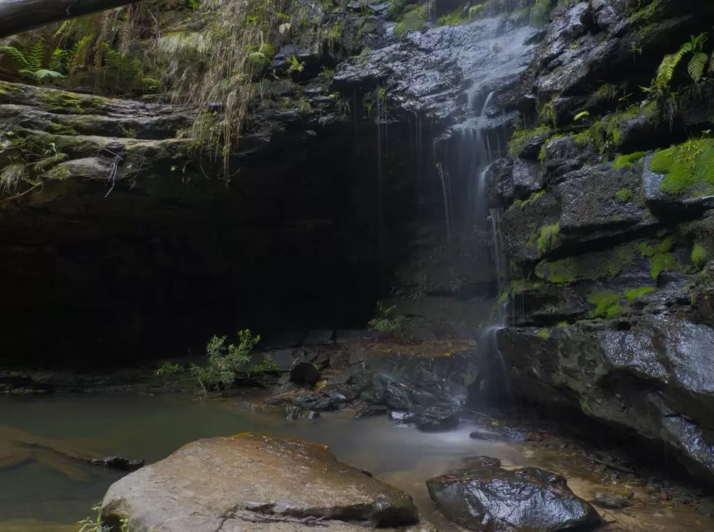
Also known as Burgess Falls walking track, this lovely walk featuring a total of five waterfalls is easily one of my favourite Blue Mountains Bushwalks. It’s great for the kids and dogs alike, most of the track is fairly flat, with a short climb down from the main track to reach each of the falls.
Being low and well shaded it is also nice and cool, it should be a lovely spot in the Summer months. The dog will no doubt enjoy a splash in the water but unfortunately the pools aren’t deep enough for a swim.
For the photographers, the super cool thing about two of these falls is the cave behind the water flow, which offers some great photo opportunities. The first cave is also full of glow worms if you head there after dark. The Aboriginals once sheltered in the cave along this track.
How to find Horseshoe Falls
The entry to the track is approximately one kilometre down Oaklands Road, Hazelbrook, on the right hand side. It’s right on a bend so I would recommend turning around in Brook Street in order to park in the clearing before the track.
The entry to the track is signposted and is right beside the metal fence over the creek on the footpath. Don’t do what I did on my first trip and wander off on a fire trail in search of it!
Length: Less than 3 kilometres
Duration: Signs say 2 hours return if you go right to Burgess Falls, but I’ve done it in not much more than that and spent a lot of time taking photos!
Terrace Falls Walking Track
Another lovely dog friendly walk in the Blue Mountains is on the other side of the highway at Hazelbrook, Terrace Falls walking track is a crescent off a local fire trail. One end of the track starts with Terrace Falls, a natural stone terrace waterfall that offers fabulous photo opportunities after some rain, and Victor Falls a short walk away.

At the other end of the track Bedford Pool is a short deviation from the main track, a large swimming hole complete with beach that will be a lovely picnic spot in summer.
How to find Terrace Falls
There are access points at both ends of the fire trail, on Lake Road and Valley Road. On Valley Road park your car at what resembles the triangle roundabout and you will see the beginning of the trail a short distance away. It is approximately a 20 minute walk to get to the Terrace Falls end, and you will pass the Bedford Pool entrance on the way. The fire trail isn’t difficult but it is deceptively steep so its harder than it looks walking out!
I haven’t taken the Lake Road entrance, but it is apparently longer
Length: A little over 4 kilometres
Duration: Approximately 2 hours
Dog friendly walks in Lawson
Waterfall Circuit
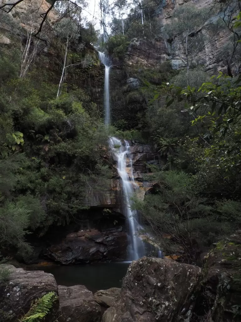
Another of the mid-mountains dog friendly bushwalks is the Lawson Waterfall Circuit. This easy walk, with an ascent/descent at either end, passes through some lovely vegetation and features four waterfalls, a couple of which the dogs will happily be able to splash around. This is one of my go-to routes for an easy walk and it is quite popular, and it is not uncommon to see a number of dogs along the track.

How to find Lawson Waterfall Circuit
Both ends of this circuit come out on Honour Avenue in Lawson. There is only a small amount of parking available so if you aren’t planning to be there early you may need to find a parking spot on the street.
Length: 3 kilometres
Duration: Approximately 90 minutes
Dantes Glen
On the other side of the Highway in Lawson there is another dog friendly walk. This is a shorter walk through Dante’s Glen to St Micheal’s Falls and back again. It does form part of a longer route called Empire Pass, but this crosses into National Park where dogs are not permitted. Indeed I even found online that dogs were not allowed on this walk, but the sign upon entry states that they are. A good map of this park can be found here.
This is a well maintained track, at least as far as Dantes Glen, with large sandstone steps installed.
How to find Dante’s Glen
I have seen a few conflicting instructions to find this walk, but it’s actually not too hard. It’s on St Bernards Drive – essentially just head for Lawson Pool and keep on driving around the back of it until the road runs out. The track will start from here.
Dantes Glen is easy to find, but if you are heading to St Michael’s Falls also this can be confusing. You will need to take the track that continues on from Dantes Glen, and when you reach the ‘No Through Path’ sign on the track look for the path on the other side of the creek.
Length: I haven’t been able to conclusively find reference to how far this route would be, but based on my smartwatch recordings I believe it would be less than 2 kilometres down and back.
Duration: Less than an hour.
Dog friendly walks in Katoomba
Katoomba Falls Reserve
This lovely little walk offers three waterfalls, a sneaky view of the Three Sisters and a great view of Orphan Rock.
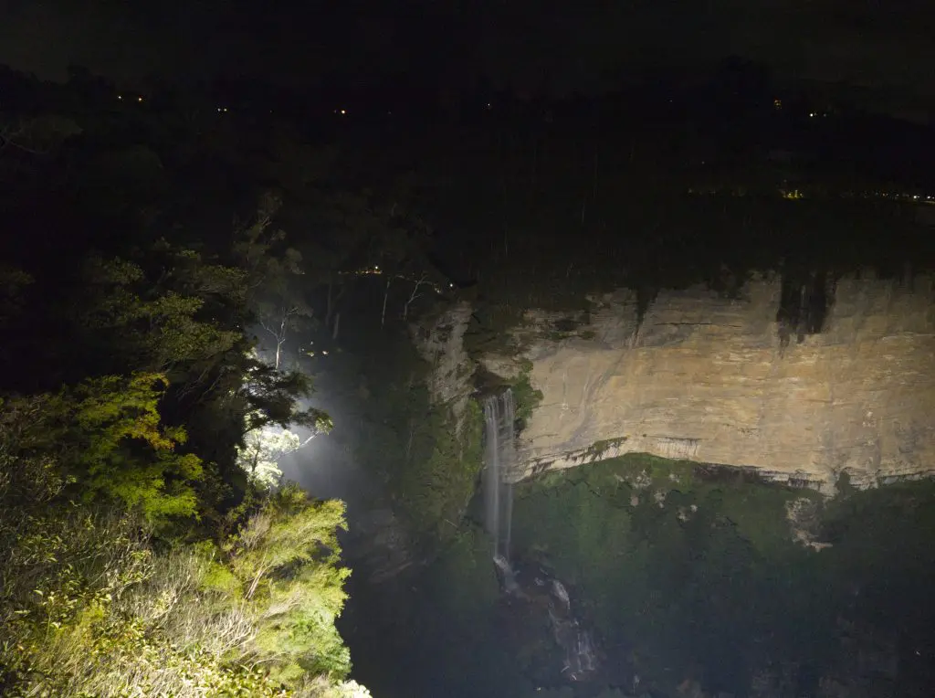
It’s also the location of the Katoomba Falls Reserve Night-lit walk, at night becoming an entirely different world with footpaths lit by 390 individual lights, and 13 spotlights focused on the main focus points of the reserve. Be aware that this only opened in February 2021 so is still a bit of a novelty, so may not be one for the dogs bothered by a lot of people.
The walk includes steps and a boardwalk, though the steps are fairly large.
How to find Katoomba Falls Reserve
Access to the reserve is either view the main Katoomba Cascades carpark or beside the old Katoomba Kiosk. if you enter via the Kiosk side you’ll see both a dogs allowed and a no dogs allowed sign which may be confusing. If you swing to the left you will be in the Katoomba Falls Reserve, while if you go right you are in the Blue Mountains National Park where dogs are not permitted.
Length: 1.3 kilometres
Duration: Under an hour
Minni Ha Ha Falls
Closed for an extended period of time for repairs, this dog friendly Blue Mountains walk has recently reopened with temporary fencing installed along the part of the walk that follows the top of the gorge.
It’s not a difficult walk down, and offers spectacular views of Minni Ha Ha Falls and the valley as you follow the cliff line to the stairs down. This is one of the larger waterfalls in the mountains, and it lands in the best swimming hole I’ve found so far up here. You literally cannot see the bottom, and I have seen it referred to as bottomless. I’m told the water is pretty cold though, so a swim is definitely something to save for a warm day!
Unfortunately due to one of the sets of stairs being effectively a ladder down, it isn’t practical to get right to the bottom with a normal sized dog. However they will be able to paddle in the stream that feeds the falls at the top.
How to find Minni Ha Ha Falls
The first time I punched this one into Google I ended up at some dubious looking properties, so make sure you head to Minni Ha Ha Road. You can park at the reserve at the end. There isn’t a huge amount of parking though and I would expect this spot to get pretty busy in Summer so this is probably one to head to early.
The walking track commences to the left of the information sign.
Length: 1.2 kilometres
Duration: You’ll want to wander round at the bottom for a bit, but this is one you could do in under an hour.
Blue Mountains Bushwalking Safety
Don’t be one of the 130 bushwalkers that get lost or require rescuing every year. Check out these safety tips and essentials and be prepared.
Dog friendly accommodation Blue Mountains
If you’re traveling with your dog, Airbnb has oodles of accommodation on offer where the pup is welcome!
Book your dog friendly Airbnb now
My Photography Equipment
If you are interested in what photography equipment I use and recommend, check out some of the results in my Photography Equipment List.
I hope you enjoy exploring the beautiful Blue Mountains with your four-legged friend!
If you liked this, please share!
Mini ha ha walk you cannot get all the way to the falls with a do as part of getting there involves climbing down a long metal ladder… impossible with a normal sized dog. But it’s a nice walk for dogs up to that ladder. Before ladder there are 2 x small waterfalls your dogs can splash about in.
Great point! I hadn’t even thought of that! I’ll adjust the commentary, thanks for the feedback
Very helpful but please add and reinforce that for all these walks dogs must be on a lead.
Many thanks.
Thanks for the feedback, I’ve incorporated this in
Brilliant info, thanks!